Save Maumee Riparian Buffer Initiative III
Jan 1, 2019 through December 31, 2020
COMPLETED Forestry Grant Narrative
through Great Lakes Restoration Initiative &
U.S. Forest Service funding for sites 7 through 9
Contact an organizer by email!
CLICK HERE TO SEE PREVIOUS PROJECTS 1-6 of Riparian Buffer Initiative from 2016-2018
Why do ditches need plants and trees? READ WHY HERE
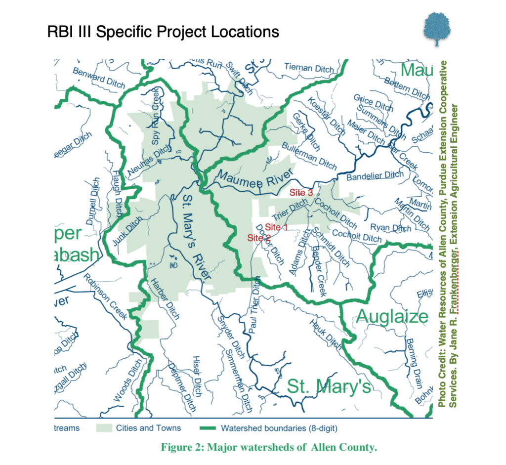
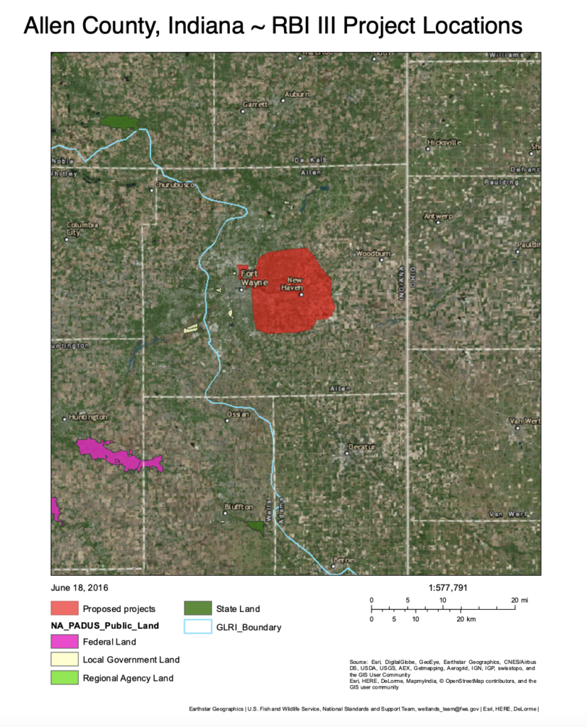
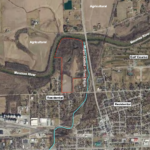
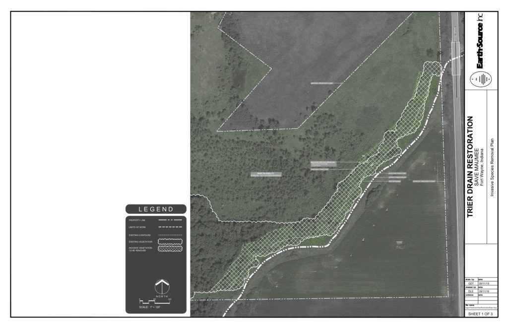
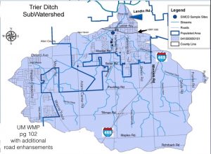
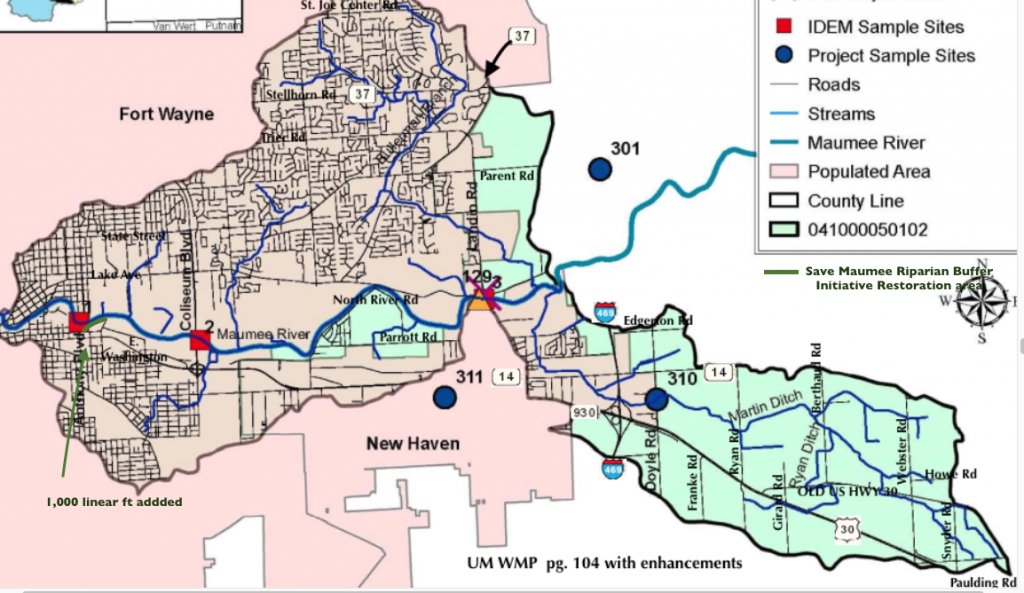
- Project location area maps for: 1. Bullerman Ditch, 2) Trier Ditch
- What types of native tree species have been approved & planted?
- 7th project (7 of 9): Meyer Road Site, 2-Day Earth Day April 22 & 23, 2019
- 8th project (8 of 9): Ellenwood Site, 2-Day Tree Planting, October 25 & 26, 2019
- 2019 Annual Report January to December 2019
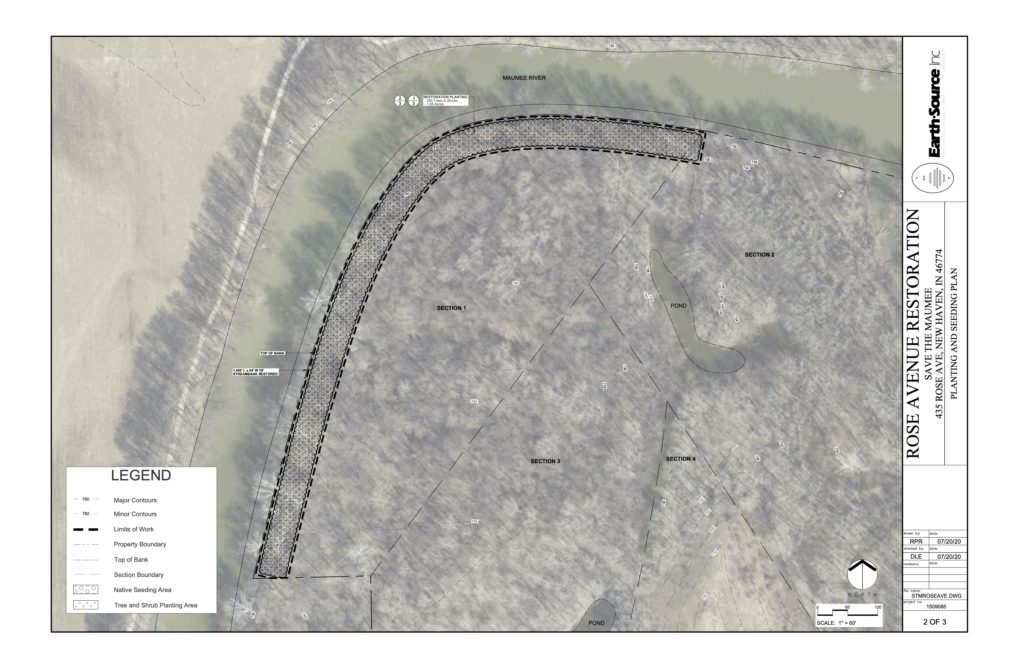
- 9th project (9 of 9) – Rose Avenue Site, AKA M&M Landfill site, 3-Day Tree Planting October 16, 17, 18, 2020
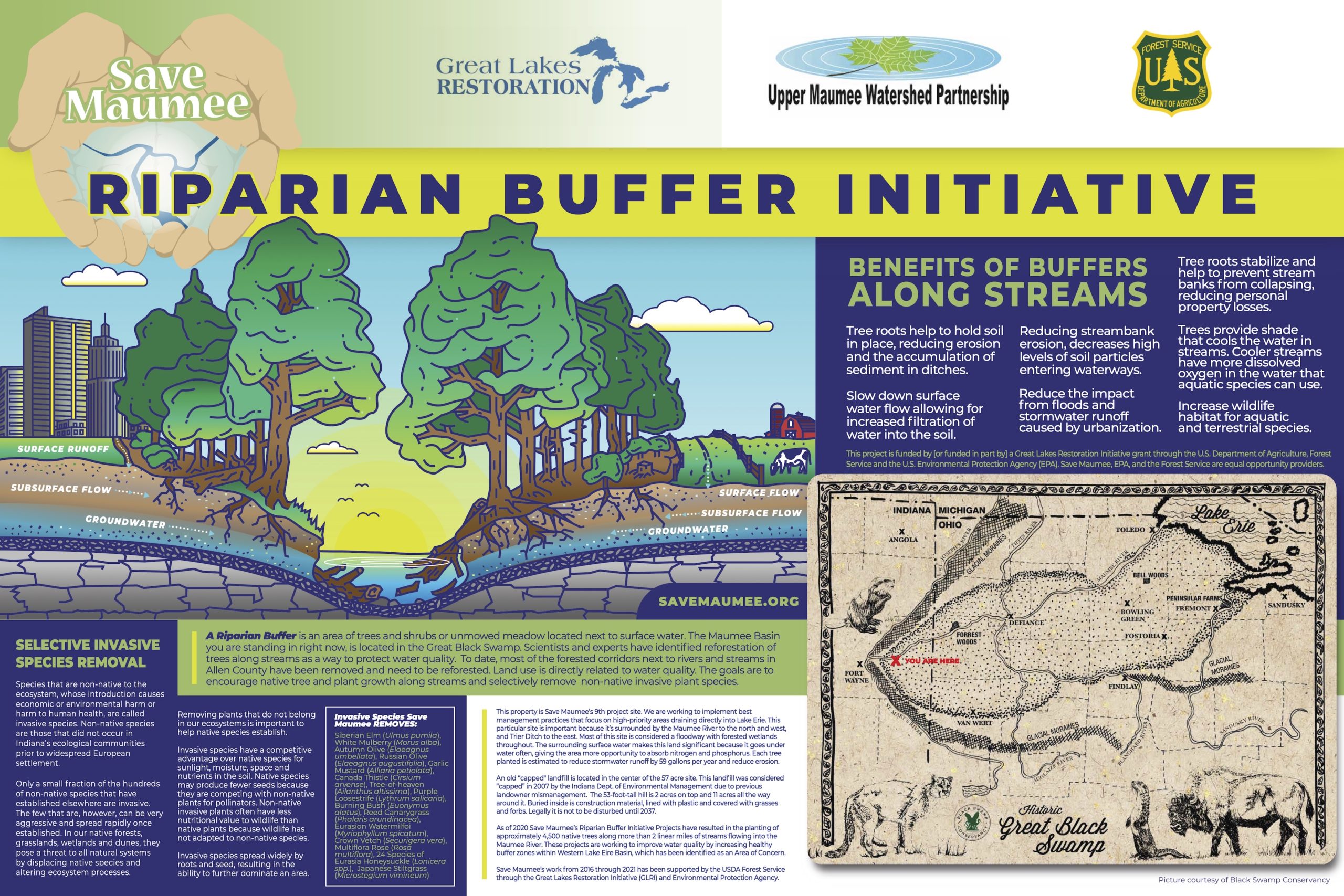
Why Save Maumee’s Riparian Buffer Initiative planting trees along the most degraded water quality streams in Allen County?
The Great Lakes Restoration Initiative (GLRI) was launched in 2010 to accelerate efforts to protect and restore the Great Lakes. Federal agencies have funded more than 4,700 projects totaling over $2.4 billion to address the most important Great Lakes priorities such as addressing agricultural nutrients and stormwater runoff, cleaning up highly-contaminated “Areas of Concern”, combating invasive species and restoring habitat. Making GLRI funding available through a competitive application process is just one way that the GLRI achieves results.
Non-federal governmental entities, including state agencies, interstate agencies, federally recognized Indian Tribes and tribal organizations, local governments, institutions of higher learning (i.e., colleges and universities), and non-profit organizations are eligible to apply for funding.
TOTAL EXPECTED RESULTS
A total of 3 riparian buffer location sites equating to >3,600 linear feet, by at least 25’ wide and maximum of 64’ wide installing / yielding over 2.2 acres of buffer and removal of invasive species, while keeping native established growth in-tact. These are the expected results of those efforts:
- 2.2 acres of healthy addition of buffers increased
- >3 acres of total invasive species acreage removed
- 1,634 native trees installed trees, median average of 5 gallon size pots
(75% trees / 25% shrubs) - 82,010 gallons of stormwater runoff reduced/year
- 10,450.5 tons of sediment reduced/year
- 33.6 pounds of phosphorus reduced/year
- 56.6 pounds of nitrogen reduced/year
Metrics of 2 Riparian Buffer Initiative Projects 2019 (Year 1 of 2)
- Total trees added: 1,084
- Total linear feet along stream: 2,250LF
- Total acreage of invasive species removed: >1.7 acres (74,250 square feet) approx.
- Gallons of Runoff Reduced: 63,956 gallons (1,084 trees x 59 gallons / tree)
- RBI volunteer hours alone: 1,883.05 hours logged by over 250 people
April 2019) “Meyer Road Site” Full Specification Information & Maps:
https://savemaumee.org/paul-trier-ditch/
October 2019) “Ellenwood Site” Full Specification Information & Maps:
https://savemaumee.org/end-of-ellenwood-drive_new-haven/
Metrics of final Riparian Buffer Initiative Project 2020 (Year 2 of 2)
- Total trees added: 550
- Total linear feet along stream: 1,400 LF
- Total acreage of invasive species removed: >1.65 acres (89,600 square feet) approx.
- Gallons of Runoff Reduced: 32,450 gallons (550 trees x 59 gallons / tree)
- RBI volunteer hours alone for 2020: 1,541.25 hours logged by 160 people
October 2020) “Rose Avenue Site” Full Specification Information & Maps:
https://savemaumee.org/earth-days-2020
*Spring 2020 planting was pushed to October 2020 due to COVID-19.
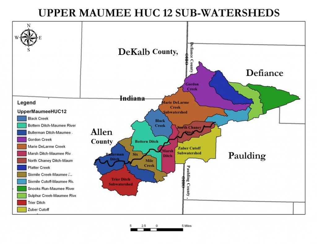
Upper Maumee River (HUC10: 0410000501) in INDIANA
Trier Ditch Subwatershed (HUC12: 041000050101)
Bullerman Ditch Subwatershed (HUC12: 041000050102)
There is an approved TMDL for the Maumee River titled Total Maximum Daily Load for E. coli Impairment in the Mary’s River Watershed and Maumee River, Adams and Allen Counties. The TMDL for the Maumee River is 125 cfu/100 mL as a geometric mean and 235 cfu/100 mL in a single day. In addition to the TMDL, each subwatershed in our project area has portions listed on the 303(d) list of impaired waterways for 2014, and the headwaters of the Maumee is listed as a 2016 priority watershed for Impaired Biotic Community.
Trier Ditch HUC12 is in the Western Lake Erie Basin and remains on the U.S. EPA Indiana 303(d) list of impaired waterways and is considered “critical” due to lack of riparian buffers, urban land-use, CSO’s and septic tank failures. Trier Watershed itself drains 18,039.4 acres within Indiana. The water from the Upper Trier Legal Drain flows northeast past “Ellenwood Site,” then passes the April 2019 tree planting site deemed “Trier Road,” and continues northeast past Waste Management of Fort Wayne/Adams Center Landfill to the Lower Trier Ditch. Both planting sites are less than 5 miles from the Maumee River’s main stem. The Maumee headwaters in Fort Wayne then flows east; through the political boundaries of the City of New Haven, Allen County and State of Indiana, eventually out-letting into Maumee Bay of Lake Erie in Toledo, Ohio.
The Trier Ditch HUC is listed as a category 4A impaired waterway for E. coli impairment above the target level. Trier Ditch encompasses 18,040.375 acres, and is primarily agricultural, with 10,358.22 acres of cropland and 5,896.552 acres of urban area. Runoff from manure application on cropland is one possible source of E. coli contamination, but the most likely, and significant source of E. coli contamination are the Combined Sewer Overflows. CSO’s are currently being addressed by the City of Fort Wayne, Long Term Control Plan. Failing septic systems are also another significant source of E. coli contamination. In samples taken in 2012 by Allen County SWCD, in conjunction with preparation for Upper Maumee Watershed Management Plan, the Trier Ditch subwatershed exceeded the target level of phosphorus (0.08mg/L) in 46% of samples, and turbidity was above the target level of 10.4 NTU in 75% of samples. The phosphorus levels are most likely the result of runoff from fertilizer applications on cropland and in urban residential areas, and turbidity levels may be the result of decreased vegetation along streambanks and riverbanks due to levee creation and maintenance.
The Bullerman Ditch subwatershed is listed on the 303(d) list of impaired waterways for 2014 as category 5A because of impaired biotic communities and nutrients, and also as category 5B for PCBs. The Bullerman Ditch subwatershed encompasses 21,570.435 acres, of which 13,213.76 acres are in urban areas, and 6,984.282 acres are cropland. In samples taken by IDEM and OH EPA as cited in the UMRWMP, levels nitrate+nitrite, TKN, and turbidity were commonly above target levels. The high nitrate+nitrite levels are likely the result of urban and agricultural fertilizer applications, while the TKN levels are likely the effect of CSOs and failing septic systems, among other causes. Above target turbidity levels may be the result of decreased vegetation along tributaries and riverbanks. The Bullerman site (Rose Ave.) is located at converging two HUC12’s and is approximately 700 feet away from the outlet of Trier Ditch into the Maumee River.
Save Maumee’s Riparian Buffer Initiative will help to address the water quality problems of excess nutrients (nitrogen and phosphorus), turbidity, and sediment load by slowing runoff. The project has the potential to help Dissolved Oxygen stay within levels of the target range (above 4 mg/L and below 9 mg/L), which in turn will help improve the health of the biotic communities of the Upper Maumee Watershed.
Full engagement and cooperation is necessary with County (Indiana) Surveyors Offices and the County Drainage Boards for current and future projects like this one. Allen County Drainage Board worked to accommodate our project plantings on one side of legal drains and ditches, holding this governing body accountable to the Indiana Drainage Handbook. This has been an added benefit to streams served by the Riparian Buffer Initiative.
Allen County Surveyors Office approved our tree plan petition with the condition the tree plantings be no closer than 5’ from top of bank outward on the non-working side of the Trier Upper Drain. Requirements include approval by a public meeting of the Allen County Drainage Board after engineering specification maps and signatures are provided on [form] Petition for Consent to Allow Permanent Structure, which was revised in 2019.
Allen County Surveyors Office cooperating with our project plantings on one side of legal drains and ditches is necessary to increase stormwater retention, habitat and stream health. After working on RBI projects for 6 years, Save Maumee realizes that Allen County (Indiana) Surveyors Office and the Allen County Drainage Board (ACDB) are important to engage. Our particular ACDB and Surveyor need education on restoration/mitigation on the 2,500 miles of legal drains they continue to clear-cut.
“501 Rose Ave. Site”
Completed October 18 over 3 days in 2020
550 native trees – 42 species
1,400 linear feet by 50 feet wide
Tree Species Selection: Yellow Buckeye, Ohio Buckeye, Shellbark Hickory, Bitternut Hickory, River Birch, Sweetgum, Redbud, Swamp White Oak, Swamp Chestnut Oak, Pin Oak, Overcup Oak, Shumard Oak, Peach Willow, Black Willow, Sandbar Willow, Sassafras, Bald Cypress, American Elm, Paw Paw (Indiana Banana), Persimmon, Yellow Birch, American Hornbeam, Hop Hornbeam, Northern White Cedar, American Beech, Hazelnut, American Sycamore,
Shrub Species Selection: Allegheny Serviceberry, Spicebush, Elderberry (American Black), Padoga Dogwood, Silky Dogwood, Aarowwood Viburnum, Nannyberry, Pussy Willow, Smooth Hydrangea, Buttonbush, Black Chokeberry, Red Chokeberry, Indigo bush, Red Osier, Winterberry
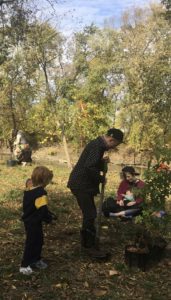
Click HERE for event pics!
“Ellenwood” along Trier Ditch
Completed October 25 & 26, 2019
482 native trees – 28 species
1,200 linear feet by 45 feet wide
Tree Species Selection: Yellow Buckeye, Bitternut Hickory, Shagbark Hickory, Northern Catalpa, Hackberry, Butternut, River Birch, Sweetgum, Black Gum, Quaking Aspen, Swamp White Oak, Bur Oak, Swamp Chestnut Oak, Chinquapin Oak, Pin Oak, Pussy Willow, Black Willow, Sassafras, Bald Cypress, American Basswood
Shrub Species Selection: Serviceberry, Spicebush, Ninebark, Elderberry, Swamp Rose, Aarowwood Viburnum, Blackhawk Viburnum, Nannyberry
Click HERE for event pics!
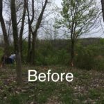
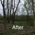
“Ellenwood Site” adding 482 trees (1,200 linear feet by 40 ft. wide) planted in October 2019 and invasive removal prep. of 48,000 square feet over 8 weeks.
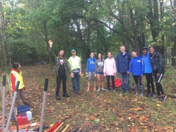
Volunteers logging 1,069.25 hours at Ellenwood between September-October 2019.
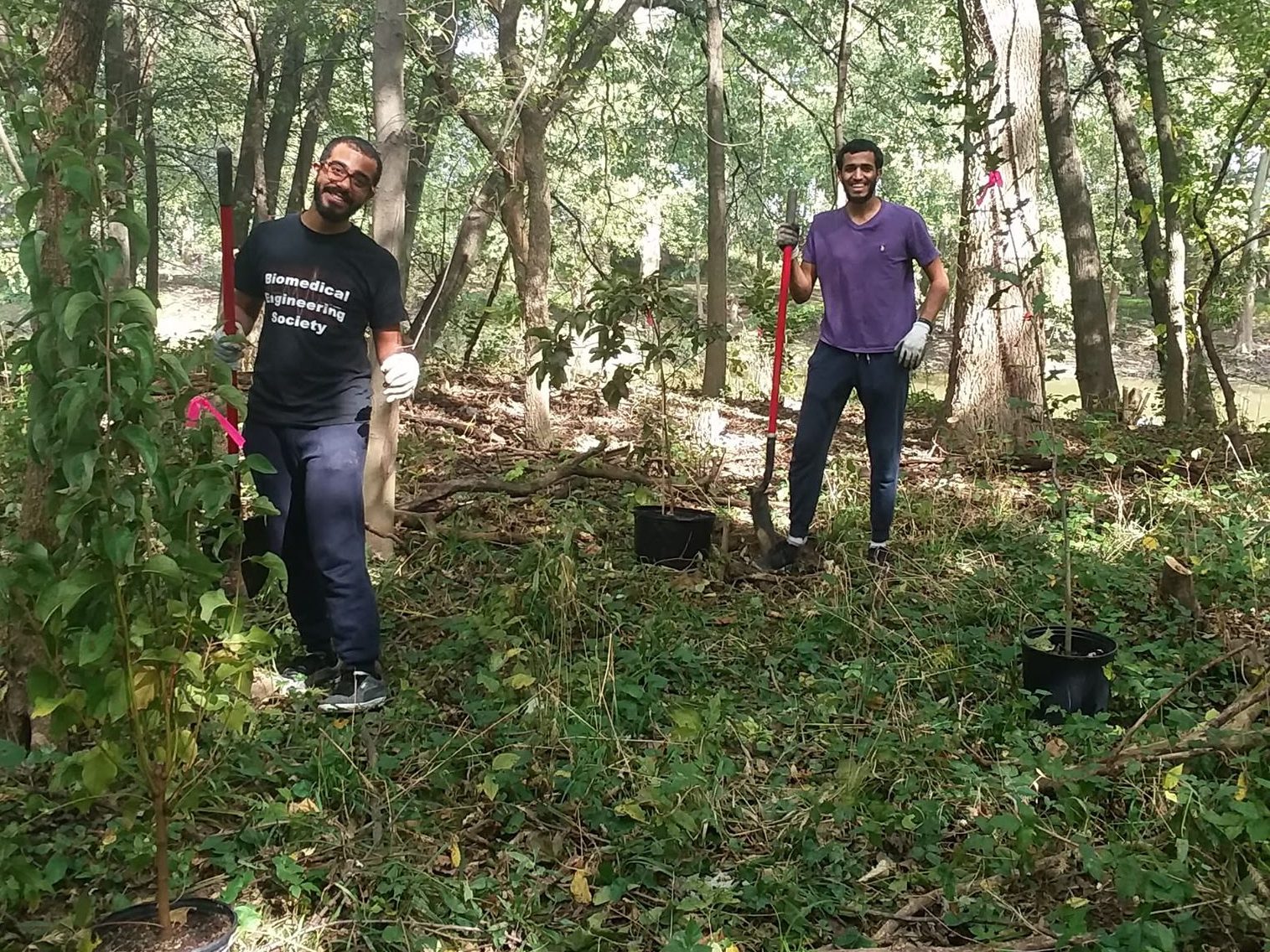
Two Riparian Buffer Initiative sites were completed in 2019, with 1 remaining site required to be completed in 2020. Invasive species continue to be a problem in all areas. Due to regular (to heavy) rain cycles this season, we purchased more invasive species removal supplies rather than watering supplies. Unwanted growth continues to be the #1 cost and time consuming portion of our land management techniques. Everyone wants to plant a tree, but selective invasive removal is more difficult and dangerous to the general public. We may not be able to continue our projects in a future grant cycle without more paid help for selective invasive removal and oversight of volunteers.
At the Meyer Road Site, bare root trees were used in April 2019 due to this industrial site having so much asphalt and gravel. Smaller trees were used do to predicted high fatality rate at the rate (on average) of 1 every 6 feet or so. Even though the requirement for this site was 380 trees, 602 bare root trees were installed and the hole was heavily backfilled with seasoned mulch, but backfilling only a small amount of poor soil. Donna Foster approved the change from potted trees to bare root trees on April 18, 2019 due to the lateness in receiving the grant award letter. Overall this did not impact the scope of the work. The soil was mostly fill dirt and gravel to raise elevation of this land, so smaller trees tend to do better and break up the clay and debris as they grow. It was beneficial to not plant larger trees. Bare areas from invasive removal were seeded with native seed at both sites.
At the Ellenwood Site, planted in October 2019, had at least 30 years of untouched growth and took over 7 weeks to prepare an area suitable for trees. Larger trees were chosen and mulch was added properly after planting. Invasive removal of almost 2 acres at Ellenwood was the heaviest clearing of an understory that we have ever undertaken. It was necessary and a new forest was created!
“Meyer Road” Site along Trier Ditch
2-Day Earth Day 2019
Completed planting site April/May 2019
600 bare root trees – 7 species
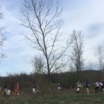
“Meyer Road Site” adding 602 bare root trees (1,050 linear feet by 25 ft. wide) planted in April / May 2019 and invasive removal prep. of 26,250 square feet. Tree selection included Black Cherry, Shagbark Hickory, Burr Oak, Swamp Chestnut Oak, Swamp White Oak, American Sycamore, Poplar (Tulip), Black Walnut.
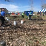
Volunteers logging 813.8 hours at Meyer Rd. between April-May 2019.
Click HERE for event pics!

